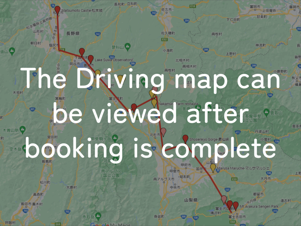
Summary
-
Start
Fukuoka Airport or Hakata Station -
Finish
Fukuoka Airport or Hakata Station -
Mileage
Total 1040km
150km per day -
Travel Pace
Normal -
Onsen Stay
Max.5 nights -
Recommended Seasons
All year round
This itinerary takes 7 days to circle north Kyushu. Due to standard mileage and by staying consecutive nights in 2 cities, you can travel at a pace that is not too rushed.
If you want to stay in Fukuoka after the road trip, it is also possible to return your car around near Hakata station.
Fukuoka – Yufuin/Beppu(Sample)
Start : Fukuoka (福岡)
Finish :Yufuin(湯布院) or Beppu(別府)
Mileage:160km
Travel Pace: Fast
On this day, you will head from Fukuoka to Yufuin or Beppu.
1
Rental car branch at Fukuoka airport or Hakata Station
Parking MAPCODE:
9:00
There are many highlight sites along today’s route. And most of the shops at Yufuin are the biggest highlight of the day close around 17:00. Therefore, we strongly recommend leaving from 8:00 to 9:00.
If your departure time is late, such as leaving in the afternoon, adjust your schedule by taking the expressway or skipping some spots.
30min
2
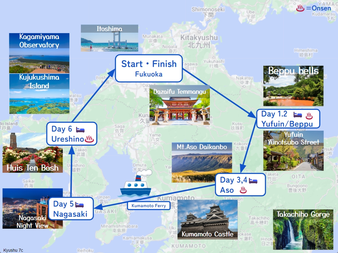
Dazaifu Tenmangu shrine-太宰府天満宮
Parking MAPCODE:
55 333 771*40What is MAPCODE?
9:30
The first destination is “Dazaifu Tenmangu Shrine”, nationally famous throughout Japan as the god of learning.
The approach from the parking lot to Tenmangu Shrine is called “Tenjin-sama-dori” avenue, which is crowded with many souvenir stores and restaurants.
If you like sweets and fruits, you can also enjoy fruit picking after visiting Tenmangu Shrine. Please refer to the driving map.
70min
3
Sofuren-想夫恋本店
Parking MAPCODE:
202 788 789What is MAPCODE?
12:00
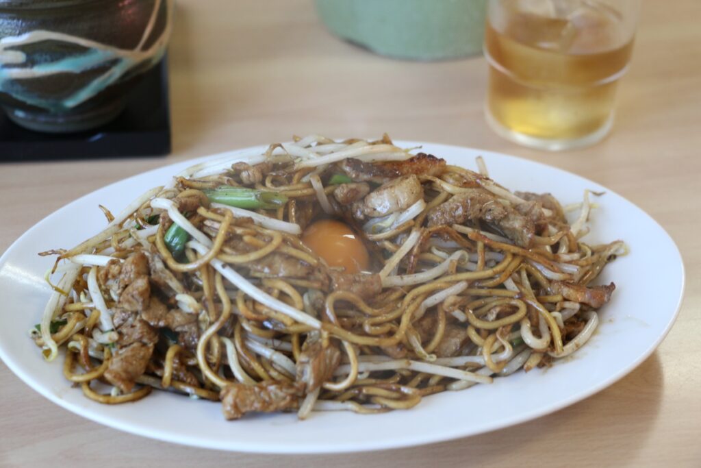
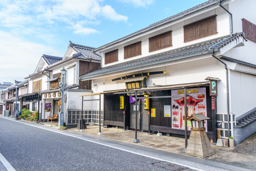
Recommended lunch is “Hita Yakisoba”, a local grilled noodle. If you have time, stop by the nearby “Hita Old Town” as it has a charming atmosphere.
After that, let’s head to Yufuin.
There are no spots between Hita and Yufuin. It is recommended to drive on the highway (E34).
50min
4
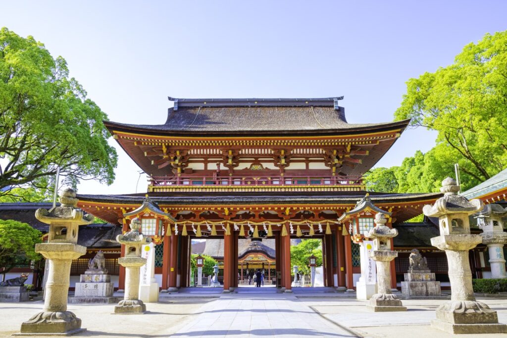
Yufuin Yunotsubo Street-湯布院湯の坪街道
Parking MAPCODE:
269 359 660*80What is MAPCODE?
13:45
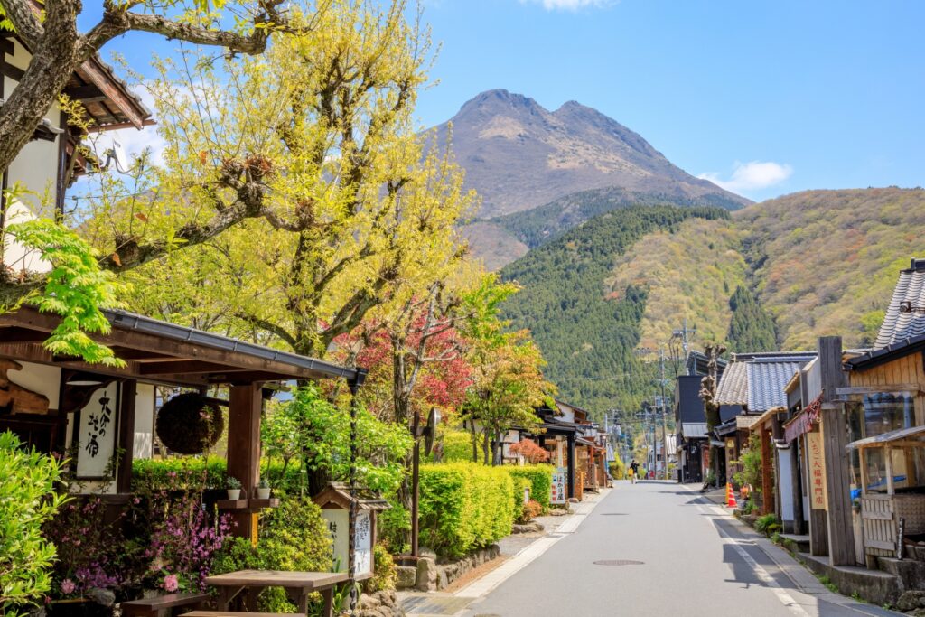
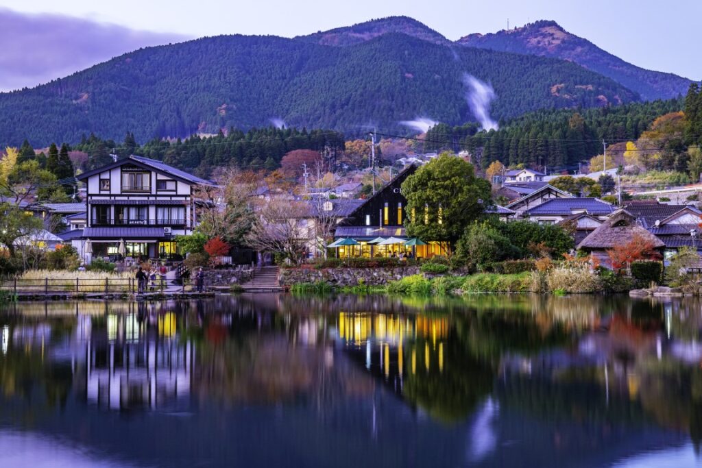
Once you arrive in Yufuin, we recommend strolling along the Yufuin Yunotsubo Kaido (Yufuin Yunotsubo Street), lined with souvenir stores and cute little sweet stores. Enjoy eating and walking to Kinrin-ko Lake at the road’s eastern end.
Another highlight of the day, the “Beppu Jigoku Hells”, will close at 17:00. If you wish to visit it, leave Yufuin by 3:30 p.m. at the latest.
30min
It is a 25-km, 30-minute drive from Yufuin to Beppu. The drive through the foot of Mt. Yufudake is exhilarating.
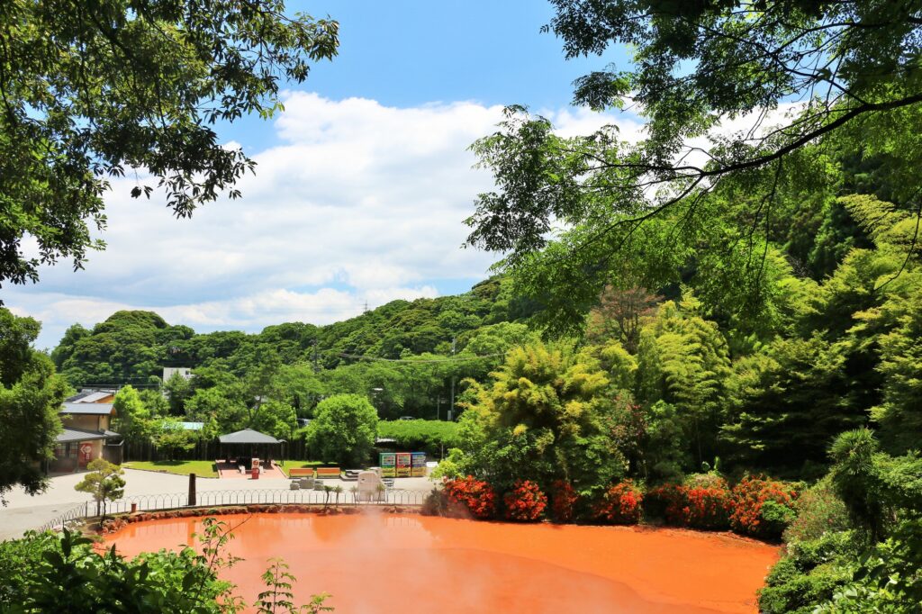
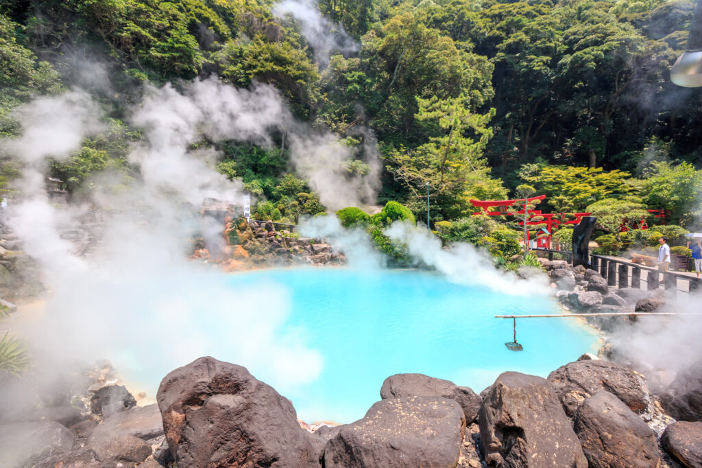
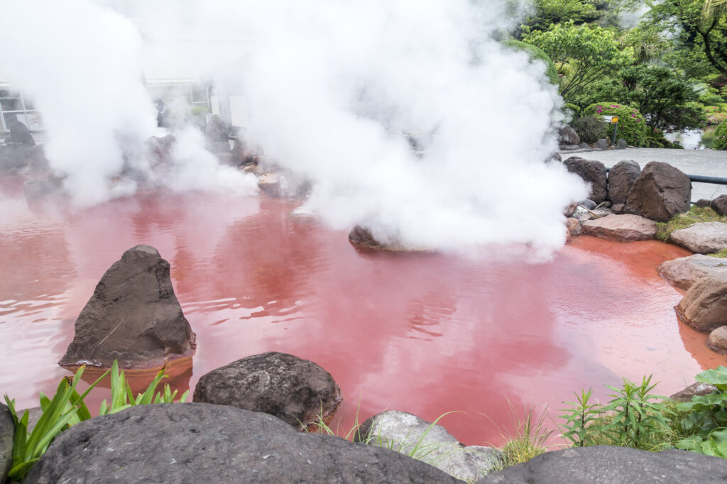
5
Beppu Jigoku Hells-べっぷ地獄めぐり
Parking MAPCODE:
46 521 411*30(Umi Jigoku)What is MAPCODE?
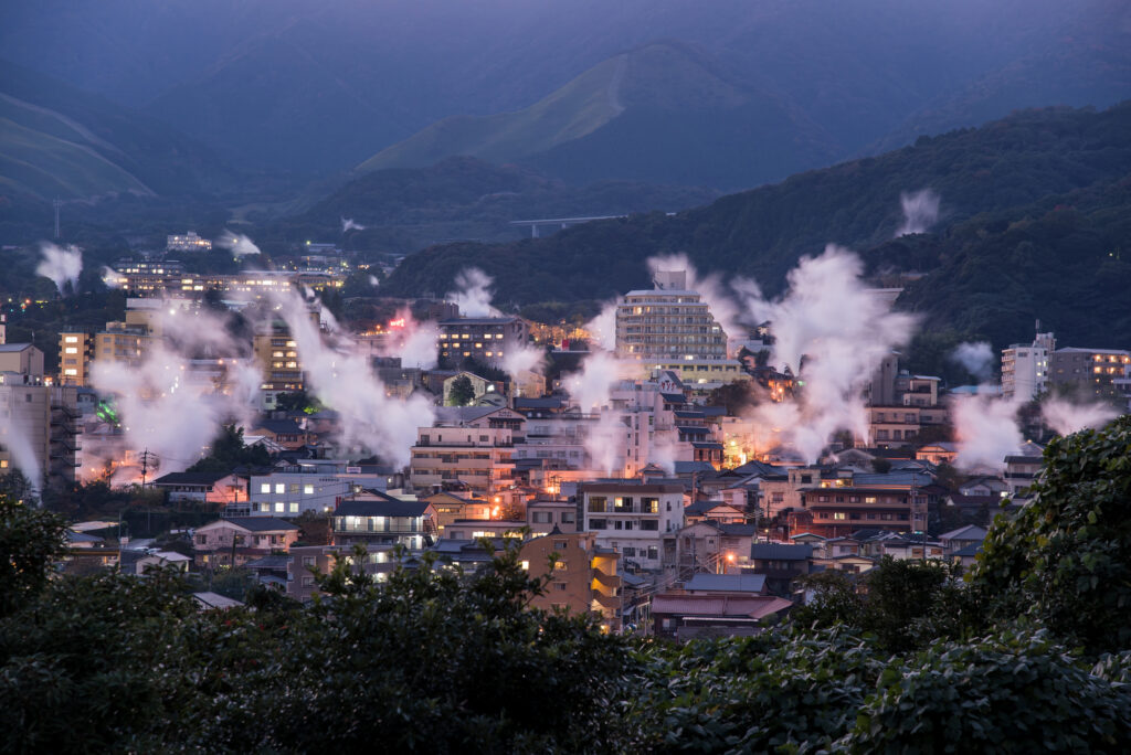
Onsen town Beppu symbolizes the “Beppu Jigoku Hells”, where hot water of various colors boils over! Five of the seven hells are within walking distance.
Be aware that the tour closes at 17:00 p.m.

15min
6
Inn in Yufuin or Beppu
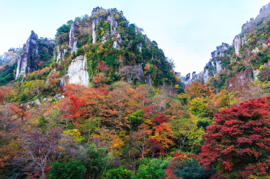
In addition, there are [Shin Yabakei Gorge(HitomeHakkei)] one of the best autumn-colored leave spot in Kyushu along the route of the day.
If you are traveling from end Oct-Mid Nov, we strongly recommend visiting.
The driving map will show additional 10-20 spots for the day! You will travel only to your favorite spots.
Check pin color and MAPCODE usage.
On this day, you will stay in either Yufuin town or Beppu city. It is 20km and takes about 30min. Both of them are nationally famous Onsen areas.
①Yufuin(湯布院)
Yufuin is small but has many luxury Onsen Ryokans.
- Inn Type
Most of these inns are 4 to 5-star Japanese-style Ryokans with Onsen facilities. - Parking
Most inns will offer free parking. - Onsen
This town is famous for Onsens and most of the inns have one. - Meal Plan Reservations
There are a few restaurants in this area, so be sure to make a reservation with a plan that includes dinner and breakfast.
②Beppu(別府)
Beppu is a Bigger City and has More Inexpensive Inns.
- Inn Type
Most of these inns are 3 to 5-star Japanese-style Ryokans with Onsen facilities. - Parking
Most inns have official parking but in addition to the accommodation fee, the parking lot fee will be charged separately. - Onsen
Beppu is famous for Onsens and most of the inns have one. - Meal Plan Reservations
As many restaurants are open till midnight, it is recommended to book your inns with breakfast only or without meals.
Yufuin/Beppu – Yufuin/Beppu🔒
Start:Yufuin/Beppu (由布院/別府)
Finish:Yufuin/Beppu (由布院/別府)
Mileage:70km
Travel Pace: Relaxed
The mileage on this day is about 70km, so you can relax and enjoy the sights.
1
Inn in Yufuin/Beppu
Parking MAPCODE:
🔒Book rental car or hotelWhat is MAPCODE?
9:00
On this day, though you will leisurely explore the city of Beppu and Yufuin, we recommend that you leave around 9:00.
20min
2
Beppu Jigoku Meguri
Parking MAPCODE:
🔒Book rental car or hotelWhat is MAPCODE?
9:20
We recommend the Beppu Jigoku Meguri (Beppu Hell Tour) at the beginning of the day. It is a tour where you can feel the hot spring power of Beppu Onsen. By using a car, you can efficiently visit the following seven sites.
●Umi Jigoku (Time required: 40 minutes) MAPCODE: 46 521 411
●Oniishibozu Jigoku (Time required:15 minutes) You can walk since it’sLocated between Umi Jigoku and the parking lot.
Kamado Jigoku (Time required: 15 minutes) MAPCODE: 46 522 481
●Oniyama Jigoku (Time required: 20 minutes) You can walk from Kamado Jigoku since it’s located about 100m there.
●Shiraike Jigoku (Time required: 20 minutes) MAPCODE: 46 522 396
●Chinoike Jigoku (Time required: 10 minutes) MAPCODE: 46 552 802
●Tatsumaki Jigoku (Time required: 10 minutes) You can walk from Chinoike Jigoku since it’s located about 100m there.
15min
3
Lunch
Parking MAPCODE:
🔒Book rental car or hotelWhat is MAPCODE?
12:30
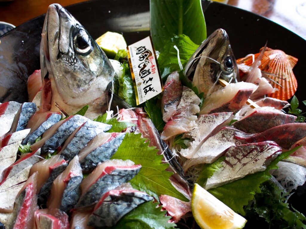
We recommend ‘Seki-saba’ for lunch on this day. There are many restaurants on the east side of Beppu Station. Mackerel and horse mackerel caught in the Bungo Channel, where the tide flows quickly, are called ‘Seki-saba’ and ‘Seki-aji’. Because of its deliciousness and crunchiness, it is valued as a luxury fish.
15min
4
Beppu Ropeway
Parking MAPCODE:
🔒Book rental car or hotelWhat is MAPCODE?
13:50
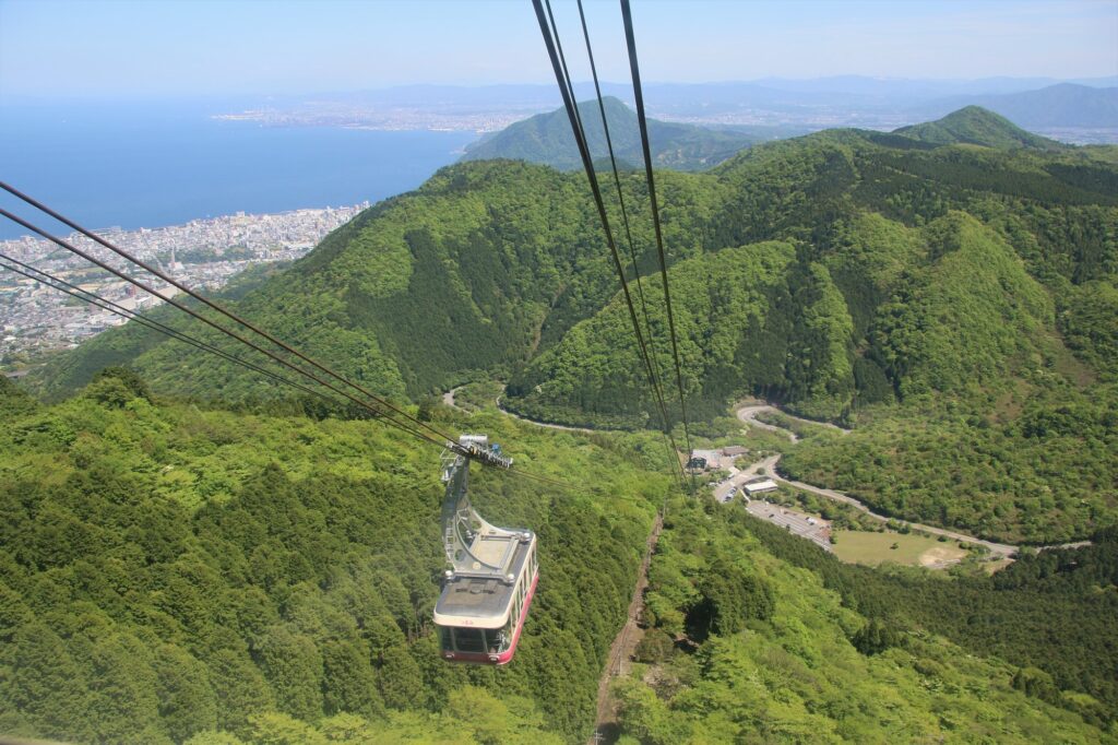
Next, you will head to Beppu Ropeway. It takes about 10 minutes from the foot of the mountain to the summit of Mt. Tsurumi, where you can enjoy a 360-degree panorama at an altitude of 1,375m. From there, you can see Beppu City, Beppu Bay, Lake Shidaka, Kijima Plateau, and the mountains of Shikoku. Cherry blossom season (Bgn Apr-End Apr) and autumn foliage season (End Oct-Mid Nov) are especially recommended.
20min
5
Yunotsubo Kaido
Parking MAPCODE:
🔒Book rental car or hotelWhat is MAPCODE?
15:40
Next, you will head to Yunotsubo Kaido in Yufuin. Yunotsubo Kaido is a very popular spot with many shops where you can enjoy eating while walking and sightseeing. We also recommend walking around Lake Kinrin.
35min
6
Inn in Yufuin/Beppu
Parking MAPCODE:
Please head to the hotel you bookedWhat is MAPCODE?
17:50
Please spend a relaxing second night in Yufuin/Beppu with gorgeous onsen.
The following sites are recommended for travelers with children.
Harmonyland is a theme park where you can meet Sanrio characters, including the popular Hello Kitty. Adults and children alike can enjoy gorgeous live shows such as the daily parade, as well as many attractions.
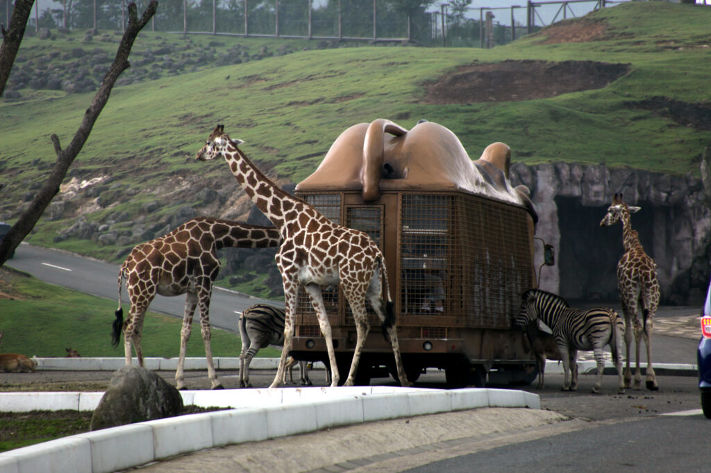
Kyushu Natural Zoological Park African Safari is the only safari park in Kyushu where wild animals live freely in a vast prairie of 1.15 million square meters.
The driving map will show additional 10-20 spots for the day! You will travel only to your favorite spots.
Check pin color and MAPCODE usage.
On this day, you will stay in either Yufuin town or Beppu city. It is 20km and takes about 30min. Both of them are nationally famous Onsen areas.
①Yufuin(湯布院)
Yufuin is small but has many luxury Onsen Ryokans.
- Inn Type
Most of these inns are 4 to 5-star Japanese-style Ryokans with Onsen facilities. - Parking
Most inns will offer free parking. - Onsen
This town is famous for Onsens and most of the inns have one. - Meal Plan Reservations
There are a few restaurants in this area, so be sure to make a reservation with a plan that includes dinner and breakfast.
②Beppu(別府)
Beppu is a Bigger City and has More Inexpensive Inns.
- Inn Type
Most of these inns are 3 to 5-star Japanese-style Ryokans with Onsen facilities. - Parking
Most inns have official parking but in addition to the accommodation fee, the parking lot fee will be charged separately. - Onsen
Beppu is famous for Onsens and most of the inns have one. - Meal Plan Reservations
As many restaurants are open till midnight, it is recommended to book your inns with breakfast only or without meals.
Yufuin/Beppu – Aso🔒
Start:Yufuin(湯布院) or Beppu(別府)
Finish: Aso(阿蘇)
Mileage:140km
Travel Pace: Normal
On this day, you will head from Yufuin/Beppu to Aso.
The driving distance is about 140 km. This is a day where you can enjoy three of Kyushu’s most spectacular driving roads.
1
Inn in Yufuin or Beppu
Parking MAPCODE:
🔒Book rental car or hotelWhat is MAPCODE?
9:00
Because there are so many pots to see, we recommend leaving by 8-9 am if you want to travel without rushing.
If you are staying in Beppu, go to the “Yukemuri Observatory” first, and you will see the typical Beppu scene of steam rising.
60min
2
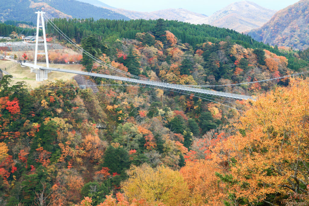
Kokonoe Suspension Bridge-九重夢大吊橋
Parking MAPCODE:
🔒Book rental car or hotelWhat is MAPCODE?
10:20
The first destination is the Kokonoe Suspension Bridge. It is the highest suspension bridge for pedestrians in Japan and is a must-see, especially during the season of fresh green leaves and autumn foliage.
40min
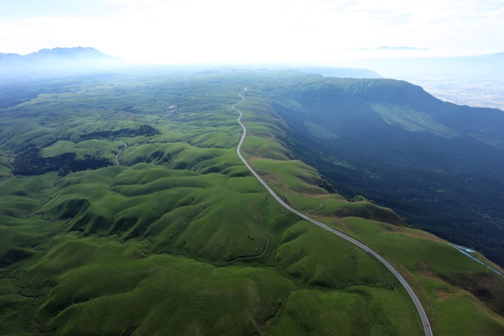
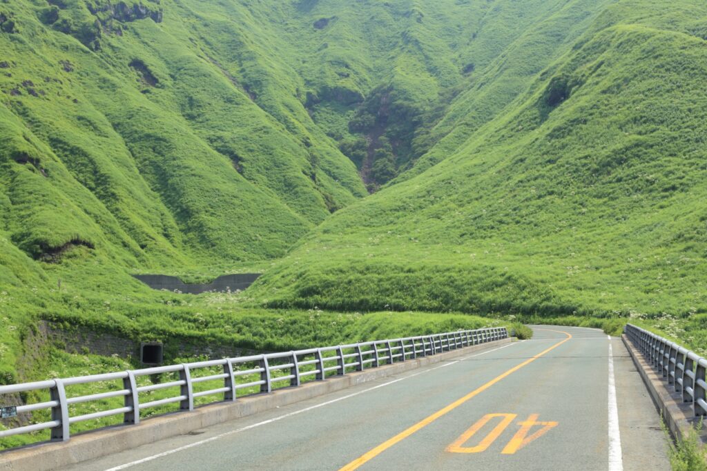
Head south on the Yamanami Highway, the third most popular driving route in Japan. On the way, you can enjoy a fresh yogurt drink at a ranch and a 1km walk in the marshland at Chojabaru. Please refer to the driving map.
Note that Yamanami Highway is a nickname and is actually a public road, not an expressway.
3
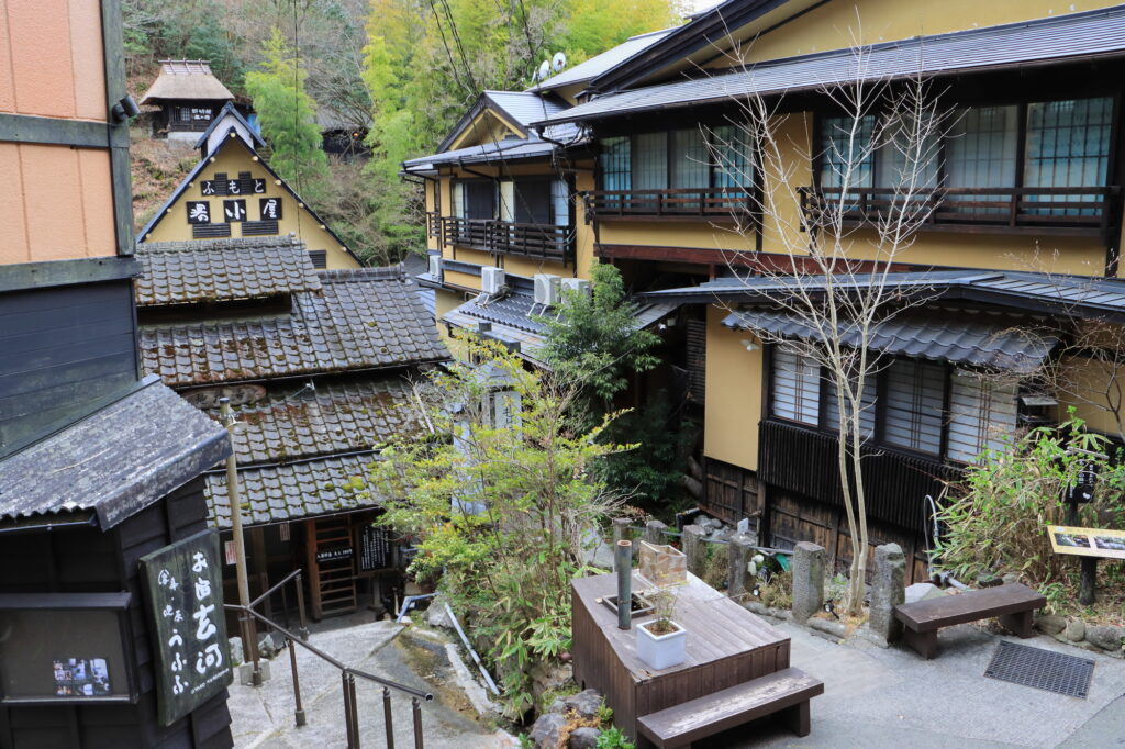
Kurokawa Onsen town-黒川温泉
Parking MAPCODE:
🔒Book rental car or hotelWhat is MAPCODE?
12:00
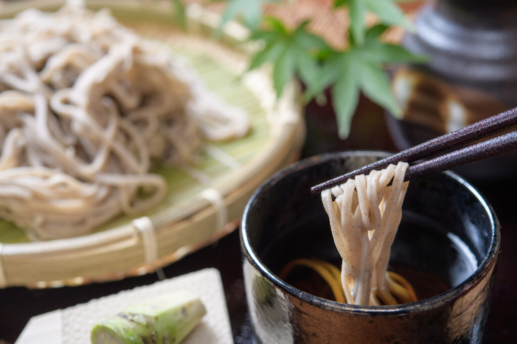
Kurokawa Onsen is a great place for lunch. There are nice curry shops and excellent cream puffs. This spot is also very crowded on holidays. Beyond Kurokawa Onsen, there are a number of soba noodle shops called Oguni Soba Road, which is also recommended. Please refer to the driving map.
35min
4
Nishiyunouraenchi Observatory-西湯浦園地展望所
Parking MAPCODE:
🔒Book rental car or hotelWhat is MAPCODE?
14:15
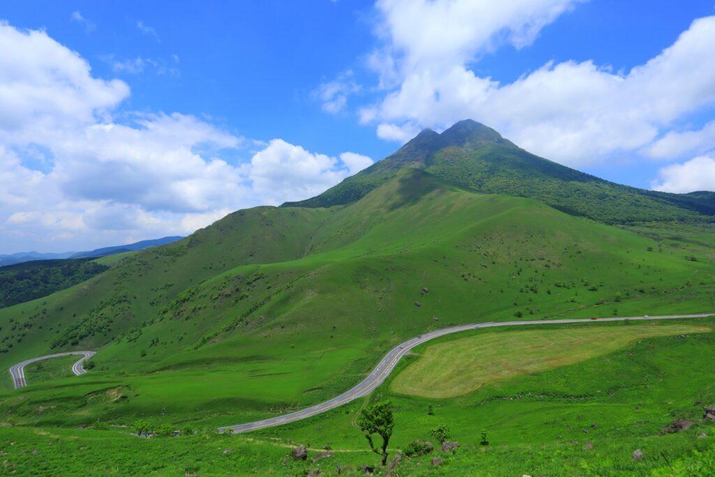
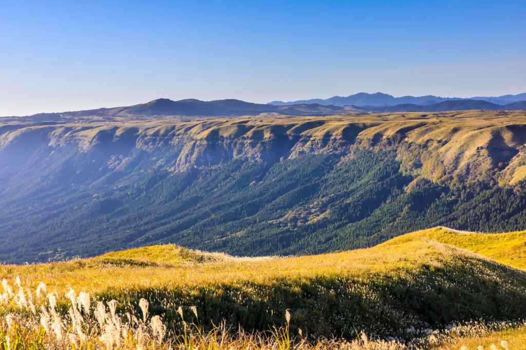
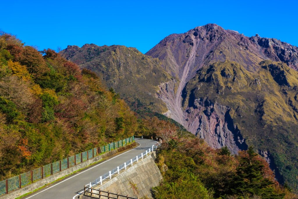
Further south down the Yamanami Highway is the “Nishiyunouraenchi Observatory”. Although not very famous, this is Drive Japan’s best lookout point overlooking the Mt.Aso caldera.
10min
The “Milk Road” from Nishiyunouraenchi Observatory to Daikanbo is the most spectacular road of this road trip, passing by the edge of the caldera of Mt.Aso. The most pleasant drive will make you want to scream, and it will surely be a memory you will cherish forever.
5
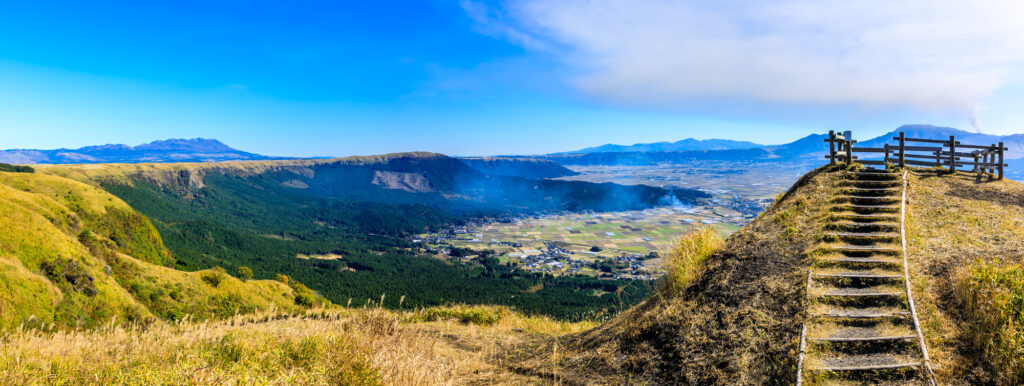
Daikanbo Observatory-大観峰
Parking MAPCODE:
🔒Book rental car or hotelWhat is MAPCODE?
14:45
This is the most famous observatory in the Mt.Aso caldera. Enjoy a 1 km round trip walk on the plateau from the parking lot to the observatory.
30min
6
Mt.Aso(Kusasenri)-草千里
Parking MAPCODE:
🔒Book rental car or hotelWhat is MAPCODE?
16:15
If you still have time, head to “Kusasenri” on Mt. Aso.
Panorama Line Road, which was ranked No. 1 in Japan in a motorcycle magazine, will greet you with the sight of vast grasslands.
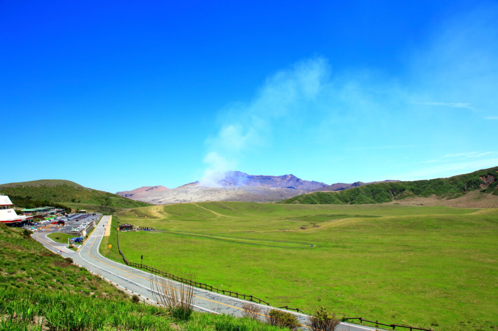
If there are no restrictions on volcanic gases, you can visit the crater. You can take the Aso Park toll road (800 yen) to the parking lot next to the crater.
Please check current restrictions before your visit.
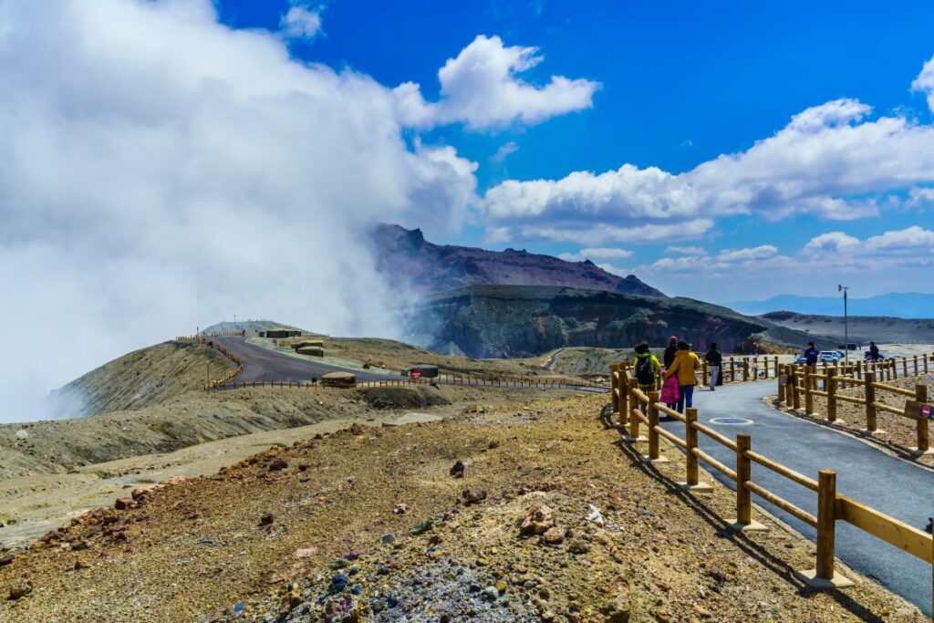
Information on restrictions for the Aso Volcano Center
30min
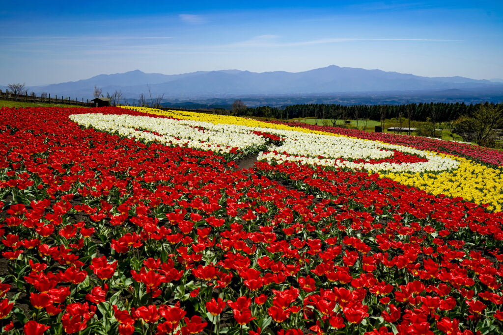
There are also flower gardens such as “Gandhi Farm” and “Kujyu Flower Park” on this day. If you are traveling during the best time for flowers, give priority to this area.
7
Inn in Aso
The driving map will show additional 10-20 hidden gems and local restaurants for the day!
You can travel freely, choosing only the spots you like!
Check pin color and MAPCODE usage.
Aso town is a small town located inside the vast caldera of Mt.Aso. The inns are spread over a wide area around Mt. Aso.
- Inn Type
There are a variety of inns from 3-star western-style hotels to 5-star Japanese Ryokans. Please book at your preferred type of inn. - Parking
Most inns will offer free parking. - Onsen
Some luxury Ryokans have Onsen. - Meal Plan Reservations
Aso is a rural area and there are few restaurants. Be sure to make a reservation with a plan that includes dinner and breakfast.
Aso – Aso🔒
Start: Aso(阿蘇)
Finish: Aso(阿蘇)
Mileage:130km
Travel Pace: Relaxing
This will be a day trip from Aso as we will be staying in Aso for a couple of nights.
The driving distance will vary depending on the destination, but in the case of the recommended round trip to Takachiho, it will be about 130 km. If you do not go to Takachiho, we recommend a relaxing trip around Mt.Aso.
1
Inn in Aso
Parking MAPCODE:
🔒Book rental car or hotelWhat is MAPCODE?
10:00
Due to the short driving distance, it is okay to depart at a leisurely pace.
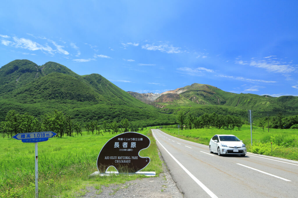
However, if you did not visit “Mt.Aso” yesterday, leave early and go there first. Driving up the Aso Panorama Line Road, which was ranked No. 1 in the national driving road rankings, you will be greeted by the sight of vast grasslands and an active volcano!
75min
2
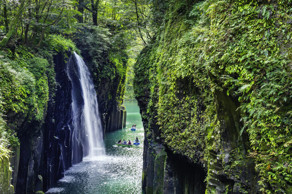
Takachiho Gorge-高千穂峡
Parking MAPCODE:
🔒Book rental car or hotelWhat is MAPCODE?
11:15
First, let’s move on at once to visit “Takachiho Gorge”. It is one of the most beautiful gorges in all of Japan and one of the most recommended spots on this entire road trip.
Boat rentals are very popular and sometimes crowded, but highly recommended!
10min
There are not many restaurants in Takachiho, but please refer to the driving map for recommended soba restaurants and Takachiho beef restaurants.
3
Kunimigaoka Observatory-国見ヶ丘展望台
Parking MAPCODE:
🔒Book rental car or hotelWhat is MAPCODE?
13:15
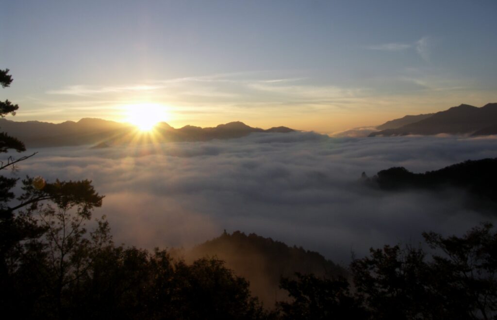
“Kunimigaoka Observatory” near Takachiho Gorge is also worth a visit. It is hard to describe from the picture, but from this 513-meter-high hill, you can see the Takachiho Basin to the east and Mount Aso to the west, and Takachiho, a town said to be the home of the gods, can be seen from all directions. It is famous for the sea of clouds, but it is also a sight to behold at other times of the year.
20min
4
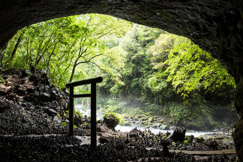
Amanoiwato Shrine-天岩戸神社
Parking MAPCODE:
🔒Book rental car or hotelWhat is MAPCODE?
14:30
10km away from Takachiho Gorge, the “Amanoiwato Shrine” is also recommended. A 10-minute walk along a riverside path called “Amanoyasukawara” will lead you to a fantastic torii gate in a cave.
60min
5
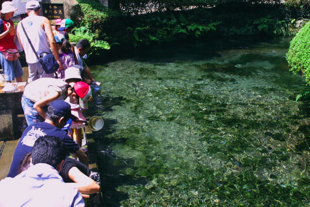
Shirakawa Suigen-白川水源
Parking MAPCODE:
🔒Book rental car or hotelWhat is MAPCODE?
16:30
Back to Aso and if you still have time, stop by “Shirakawa Suigen”. You can draw natural water from the foot of Mt. Aso.
30min
There are some cherry blossom viewing spots along the route on this day. If you visit during the cherry blossom season, please refer to the driving map.
6
Inn in Aso
Parking MAPCODE:
Please head to the hotel you reserved.What is MAPCODE?
Let’s return to the same inn in Aso as the previous day.
The driving map will show additional 10-20 sightseeing spots and local restaurants for the day!
You can travel freely, choosing only the spots you like!
Check pin color and MAPCODE usage.
Aso town is a small town located inside the vast caldera of Mt.Aso. The inns are spread over a wide area around Mt. Aso.
- Inn Type
There are a variety of inns from 3-star western-style hotels to 5-star Japanese Ryokans. Please book at your preferred type of inn. - Parking
Most inns will offer free parking. - Onsen
Some luxury Ryokans have Onsen. - Meal Plan Reservations
Aso is a rural area and there are few restaurants. Be sure to make a reservation with a plan that includes dinner and breakfast.
Aso – Nagasaki🔒
Start: Aso(阿蘇)
Finish:Nagasaki(長崎)
Mileage:150km
Travel Pace: Fast
On this day, you will head from Aso to Nagasaki.
The distance traveled is more than 150 km, and you need to be careful with the schedule as you will be traveling by car ferry from Kumamoto Port to Shimabara Port.
1
Inn in Aso
Parking MAPCODE:
🔒Book rental car or hotelWhat is MAPCODE?
9:00
If you want to visit Mt. Aso or Kumamoto Castle, we recommend that you leave before 8:00 – 9:00 a.m. because you must arrive at Kumamoto Port by 1:00 p.m. at the latest.
70min
2
Kumamoto Castle-熊本城
Parking MAPCODE:
🔒Book rental car or hotelWhat is MAPCODE?
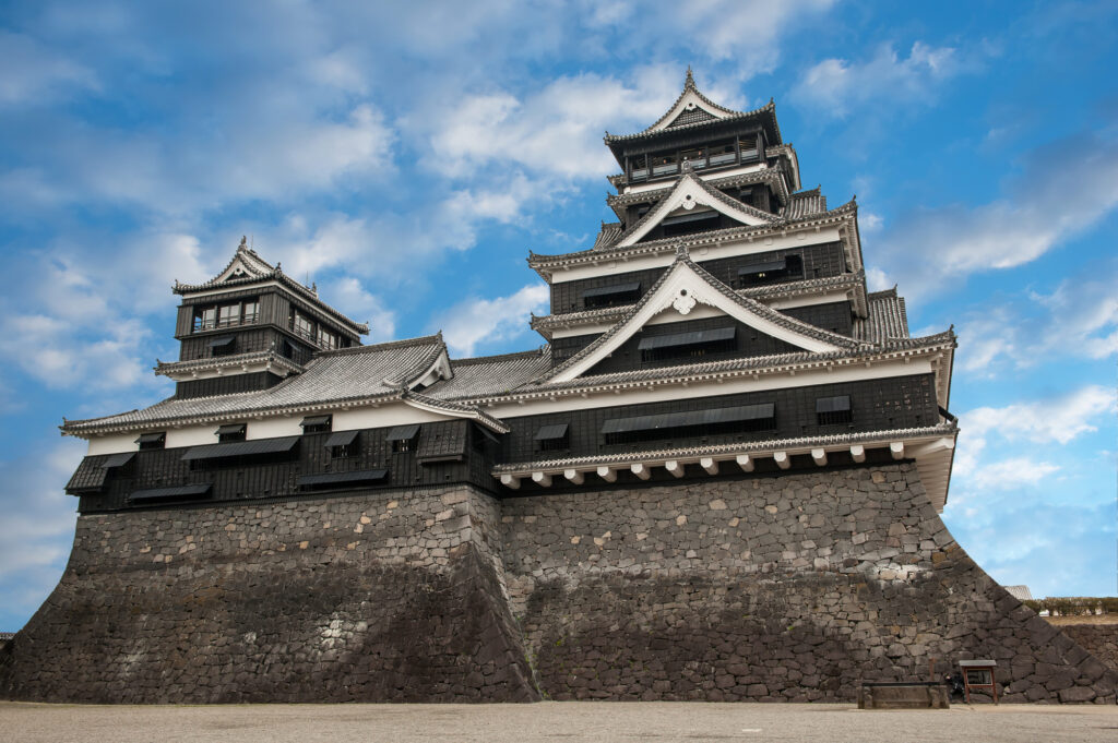
10:10
First, we will head to Kumamoto Castle, the symbol of Kumamoto, which was damaged by the Kumamoto Earthquake in 2016, but restoration work on the castle tower was completed in March 2021.
Please leave here by 12:00 p.m. to catch the ferry.
20min
3
Kumamoto Ferry
Parking MAPCODE:
🔒Book rental car or hotelWhat is MAPCODE?
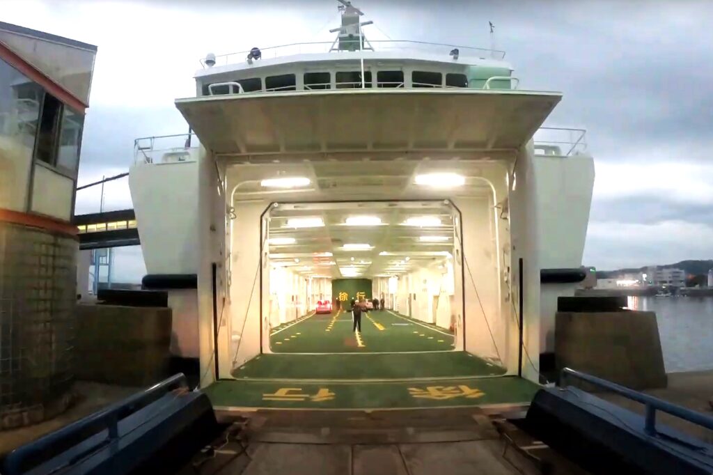
12:30
On this day, you will cross the Ariake Sea by car ferry from Kumamoto Port to Shimabara Port.
There are two ferry companies, Kumamoto Ferry(熊本フェリー) and Kyusho Ferry(九商フェリー). Kumamoto Ferry is slightly more expensive but takes half the time.
Drive Japan recommends the Kumamoto ferry which departs at 13:00.
Be sure to catch the 13:40 departure of the Kyusho Ferry at the latest.
For passenger cars, please complete the boarding procedure 20 minutes before departure.
| Kumamoto Ferry | Kyusho Ferry | |
| Fare | JPY3,980 | JPY3,690 |
| Cruise time | 30min | 60min |
| Departure Time | 13:00 | 12:25 or 13:40 |
Kumamoto Ferry(熊本フェリー)
Kyusho Ferry(九商フェリー)
5
Himematsuya-姫松屋 本店
Parking MAPCODE:
🔒Book rental car or hotelWhat is MAPCODE?
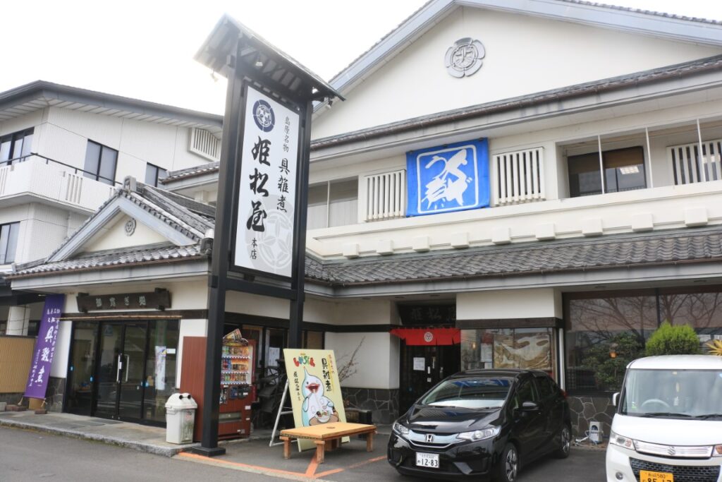
Once you arrive at Shimabara Port, let’s have lunch.
We recommend Shimabara’s traditional dish, Guzoni(具雑煮), a healthy hot pot with 13 different ingredients.
40min
6
Unzen Jigoku Hell-雲仙地獄
Parking MAPCODE:
🔒Book rental car or hotelWhat is MAPCODE?
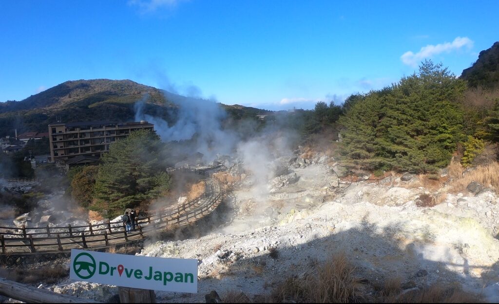
15:15
After that, let’s head to Unzen Jigoku Hell. In the center of Unzen, famous for its volcanoes and hot springs, you can stroll through the fantastic sight of steam erupting.
If the weather is fine, it is also recommended to drive along the nearby “Nitatoge Circular Road(仁田峠循環道路) and visit the NitaPass 2nd Observatory. You can enjoy a spectacular view overlooking Shimabara City and the Ariake Sea.
The journey from Unzen Hell to Nagasaki is about 50 km, or 1 hour and 10 minutes.
70min
7
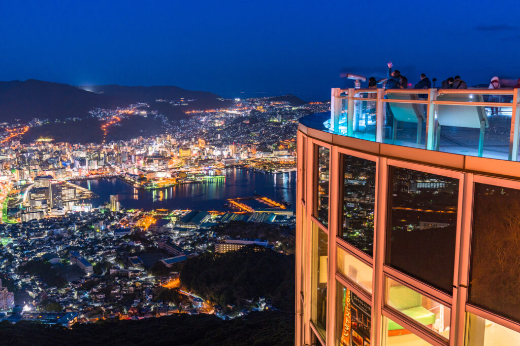
Mt.Inasayama observatory-稲佐山展望台
Parking MAPCODE:
Please refer driving mapWhat is MAPCODE?
17:30
Mt.Inasa, one of Japan’s top three nightscapes along with Mt.Hakodate in Hokkaido and Mt. Rokko in Kobe.
Please remember that general vehicles are not allowed to enter the summit park between 18:00 and 22:00 on Saturdays, Sundays, national holidays, and during peak season. If you wish to climb the mountain during these hours, use the ropeway.
You can refer to MAPCODE for parking for both the summit and the ropeway on the driving map.
20min
8
Inn in Nagasaki
Parking MAPCODE:
Please head to the hotel you reserved.What is MAPCODE?
You can visit Peace Park, Dejima, and the rest of the city tomorrow.
Also, if you stay only one night in Nagasaki, you will not have enough time to explore the city. If you want to visit Atomic Bomb Museum, Dejima, or the famous Gunkanjima (Battleship Island), we recommend you stay one more night in Nagasaki.
The driving map will show additional 10-20 sightseeing spots and local restaurants for the day!
You can travel freely, choosing only the spots you like!
Check pin color and MAPCODE usage.
On this day, you will stay in Nagasaki city(長崎) which is famous for its night view and the atomic bomb.
The inns are concentrated in between “Nagasaki Station” and “China Town”. If you prefer luxury inns, it is also recommended to stay on Mt.Inasayama side.
- Inn Type
Most of these inns are 3 to 5-star western-style hotels. - Parking
Some inns have official parking but in addition to the accommodation fee, the parking lot fee will be charged separately. - Onsen
There is no Onsen in this town and no inns have Onsens. - Meal Plan Reservations
As many restaurants are open till midnight, it is recommended to book your inns with breakfast only or without meals.
Nagasaki – Ureshino🔒
Start:Nagasaki(長崎)
Finish:Ureshino(嬉野) or Takeo(武雄) or Huis Ten Bosch
Mileage:170km
Travel Pace: Fast
On this day, you will leave Nagasaki for Ureshino Onsen town or Takeo Onsen town.
The two towns are only about 15 km apart, so you can stay in either town. It is also a good idea to stay in “Huis Ten Bosch”.
The driving distance on this day is long, approximately 170 km, and there is no expressway so you need to travel at a slightly faster pace.
1
Inn in Nagasaki
Parking MAPCODE:
🔒Book rental car or hotelWhat is MAPCODE?
9:00
If you want to take your time in Nagasaki city, it is recommended to leave early.
The opening hours of major sightseeing spots in the city are as follows.
| Open | |
| Glover Garden | 8:00 |
| Atomic Bomb Museum | 8:30 |
| Dejima | 8:00 |
2
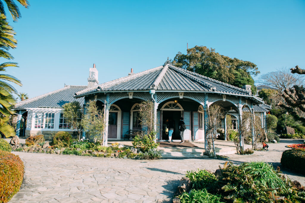
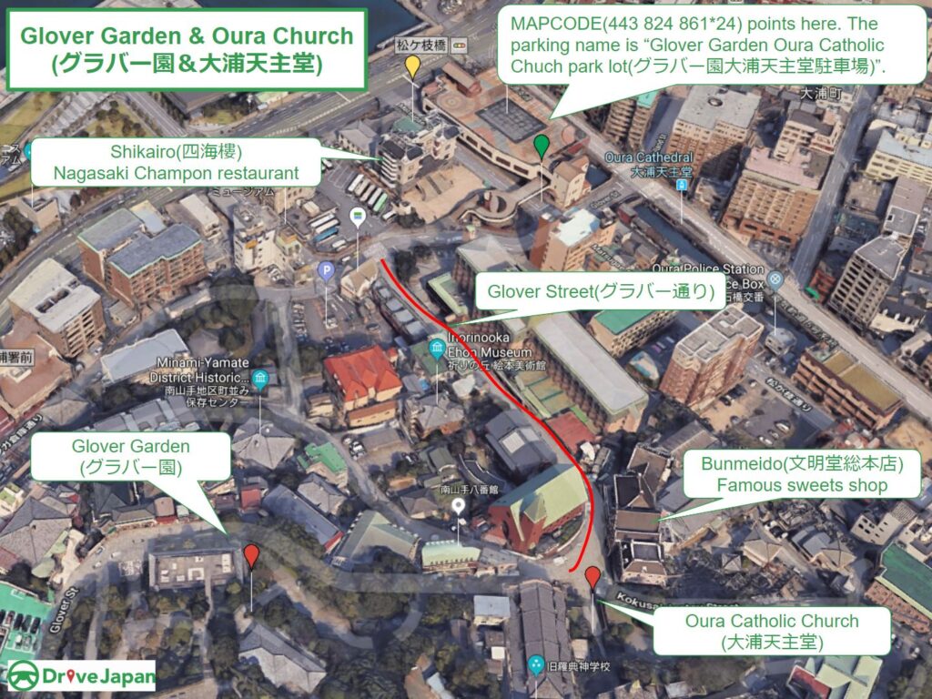
Glover Garden&Oura Catholic Church-グラバー園&大浦天主堂
Parking MAPCODE:
🔒Book rental car or hotelWhat is MAPCODE?
9:10
Glover Garden and Oura Tenshudo are very close by, so park in the public parking lot and walk.
The slope is very steep, so comfortable walking shoes are recommended.
From Glover Garden, you can enjoy a panoramic view of Nagasaki’s harbor.
15min
3
Nagasaki Atomic Bomb Museum-長崎原爆資料館
Parking MAPCODE:
🔒Book rental car or hotelWhat is MAPCODE?
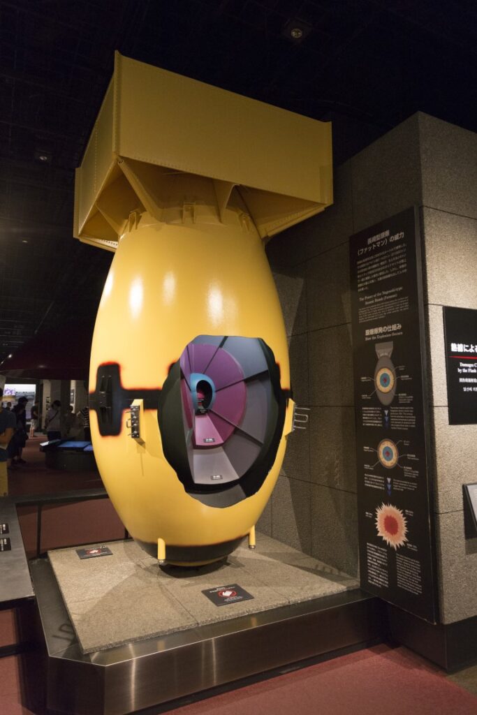
This is a museum about the atomic bomb dropped on Nagasaki in 1945. There is also a Peace Park 500 meters away, but the museum is more recommended.
40min
4
Roadside Station Yuhigaoka Sotome-道の駅 夕陽が丘そとめ
Parking MAPCODE:
🔒Book rental car or hotelWhat is MAPCODE?
12:30
After 40 minutes from Nagasaki City, you will arrive at “Roadside Station Yuhigaoka Sotome”.
40min
From here, you can enjoy an exhilarating drive along the beautiful coastal road, Nagasaki Sunset Road, to the north.
5
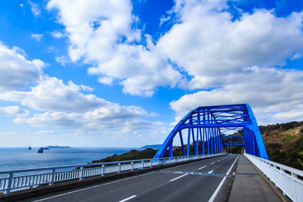
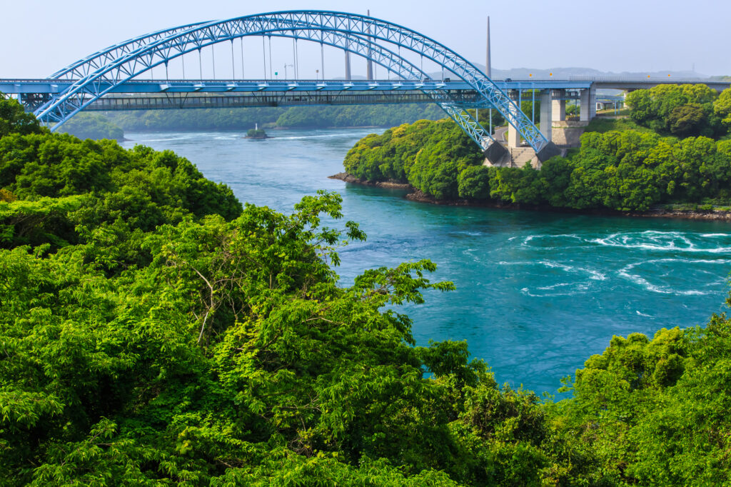
Saikaibashi Bridge-西海橋
Parking MAPCODE:
🔒Book rental car or hotelWhat is MAPCODE?
13:20
At Saikai Bridge, you can see the whirlpools if the timing is right. There are also souvenir stores and restaurants, perfect for a rest stop.
40min
Huis Ten Bosch, Kyushu’s largest theme park, is located 15 minutes from Saikai Bridge.
It offers seasonal flowers, attractions, and a variety of events. You will need at least half a day to visit Huis Ten Bosch, so it is recommended that you stay directly in the park or at an inn in the area.
6
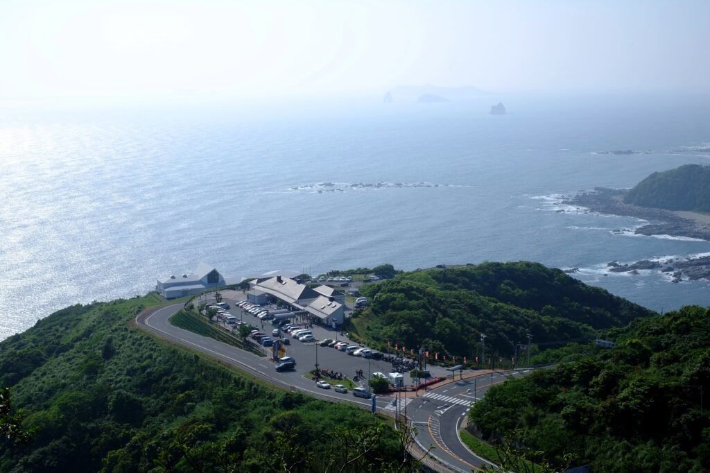
Ishidake Observatory-石岳展望台
Parking MAPCODE:
🔒Book rental car or hotelWhat is MAPCODE?
The biggest highlight of the day was the Ishidake Observatory.
Generally speaking, the other observatory “Tenkaiho observatory” is more famous, but Ishidake Observatory, which is not accessible by bus, is higher in elevation and is by far the best place to enjoy a truly 360-degree panoramic view of Kujuku Islands and the city of Sasebo with its huge shipbuilding yard.
Tenkaiho observatory is also a famous place for flowers. The rape blossoms and cosmos season are especially recommended.
50min
The Sasebo area is also nationally famous for its Sasebo Burger. The famous shop is listed on the driving map, so why don’t you try?
7
Inn in Ureshino Onsen or Takeo Onsen
Parking MAPCODE:
Please head to the hotel you reserved.What is MAPCODE?
In the evening, relieve your fatigue in the hot springs of Ureshino and Takeo.
The driving map will show additional 10-20 sightseeing spots and local restaurants for the day!
You can travel freely, choosing only the spots you like!
Check pin color and MAPCODE usage.
On this day, you will stay in either Takeo Onsen town or Ureshino Onsen town. It is 15km and takes about 30min. Both of them are famous for their Onsen. Takeo has more luxury inns.
- Inn Type
Most of these inns are 3 to 5-star Japanese-style Ryokans with Onsen facilities. - Parking
Most inns will offer free parking. - Onsen
This town is famous for Onsen and most of the inns have one. - Meal Plan Reservations
There are some restaurants around the hotel for dinner but most inns also provide dinner plans, so please make reservations according to your preference.
Ureshino – Fukuoka🔒
Start:Ureshino(嬉野) or Takeo(武雄) or Huis Ten Bosch
Finish: Fukuoka(福岡)
Mileage:160km
Travel Pace: Normal
On this day, we will return to Fukuoka from Ureshino.
The driving distance is about 160 km.
1
Inn in Ureshino Onsen
Parking MAPCODE:
🔒Book rental car or hotelWhat is MAPCODE?
Because there are so many spots to see, we recommend that you leave by 8-9 am if you want to travel without rushing.
If you are not staying in Fukuoka today and will be taking the Shinkansen or airplane, please arrange your schedule so that you can return the rental car to the rental store at least one and a half hours before your flight.
20min
2
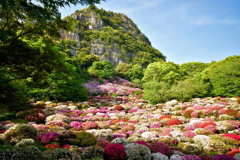
Mifuneyama Rakuen garden-御船山楽園
Parking MAPCODE:
🔒Book rental car or hotelWhat is MAPCODE?
9:20
First, stop by Mifuneyama Rakuen, located near Takeo Onsen.
This garden was created in 1845 and offers a variety of seasonal scenery including cherry blossoms, wisteria, azaleas, and autumn leaves.
35min
3
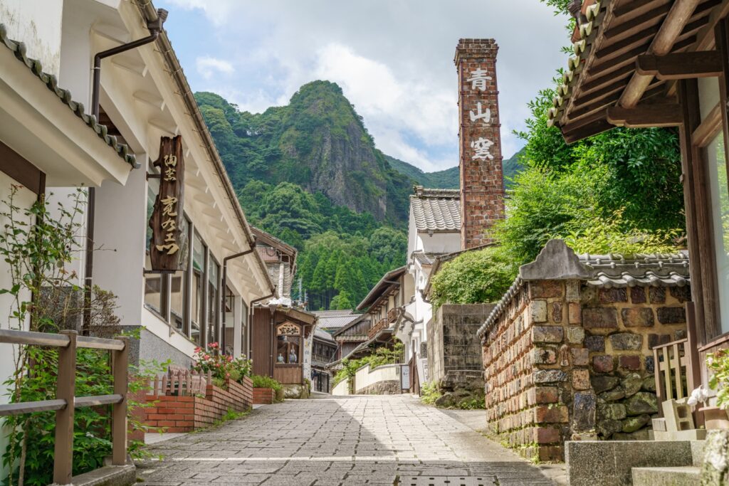
Imari Okawa Uchiyama-伊万里大川内山
Parking MAPCODE:
🔒Book rental car or hotelWhat is MAPCODE?
10:45
Imari and Arita are world-famous for porcelain, and here in Okawauchiyama, the official kiln of the Saga Clan was located. The scene of many kilns quietly lined up in the mountains was to prevent the leakage of advanced technology to the outside world and it truly makes this place a hidden village.
60min
4
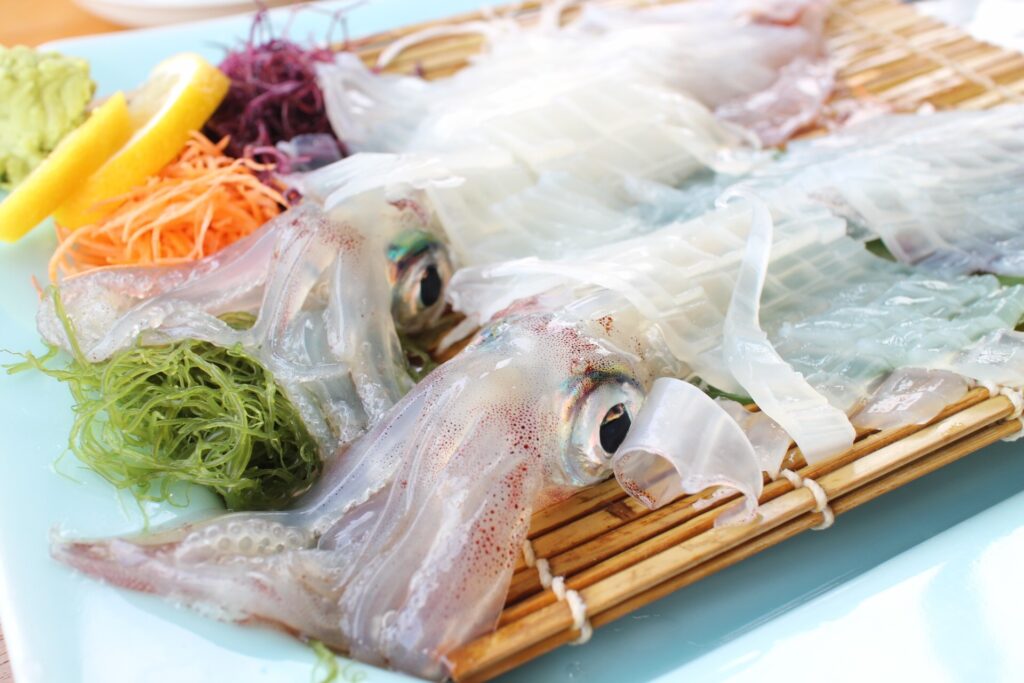
Under Water restaurant Manbo-海中魚処萬坊
Parking MAPCODE:
🔒Book rental car or hotelWhat is MAPCODE?
12:45
If you have enough time for lunch, it is highly recommended to go to Yobuko town for squid. You can enjoy wonderfully fresh and delicious squid that is as good as Hakodate’s.
50min
5
Kagamiyama Observatory-鏡山展望台
Parking MAPCODE:
🔒Book rental car or hotelWhat is MAPCODE?
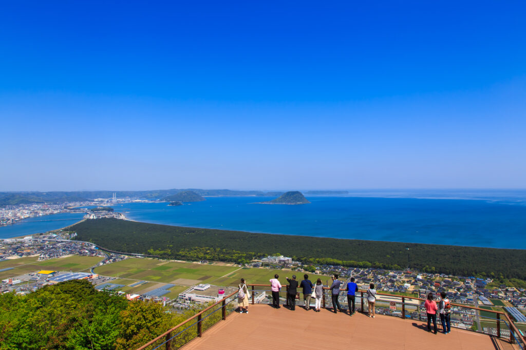
15:10
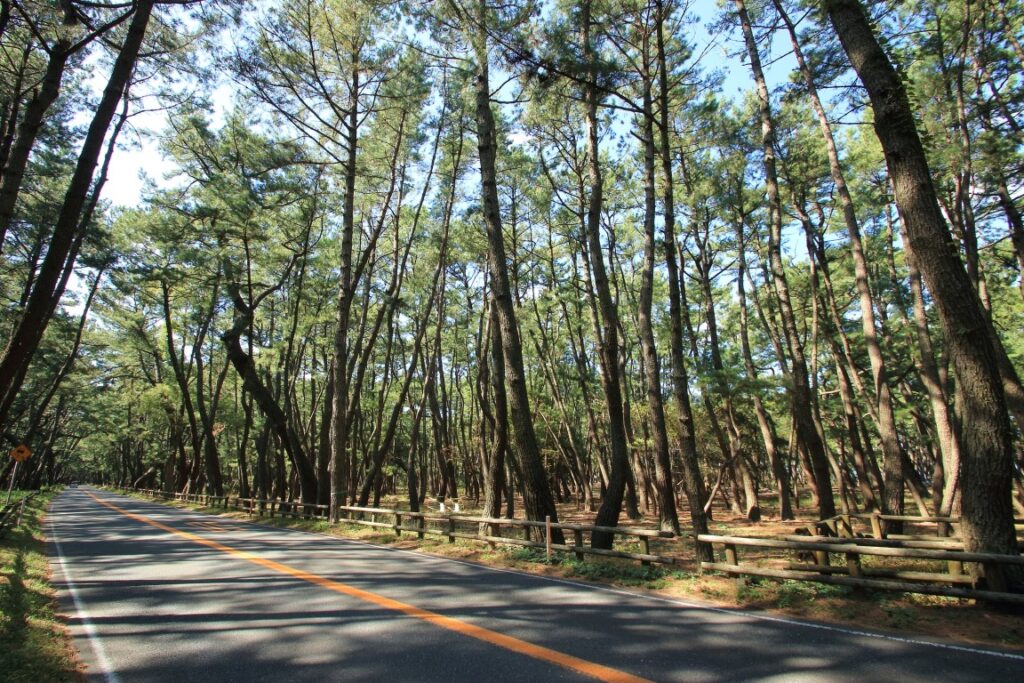
The biggest highlight of the day is the Kagamiyama Observatory. It is one of the most beautiful observatories in Kyushu with a panoramic view of Niji-no-Matsubara pine forest, Karatsu Castle, and Karatsu Bay, and it is a wonder that it is not more famous.
At the foot of the observatory is a 4.5 km-long pine forest of one million pine trees called “Niji-no-Matsubara. You can also enjoy driving through the pine forest, so please refer to the driving map.
60min
6
Sakurai Futamigaura Couple Rock-桜井二見ヶ浦の夫婦岩
Parking MAPCODE:
🔒Book rental car or hotelWhat is MAPCODE?
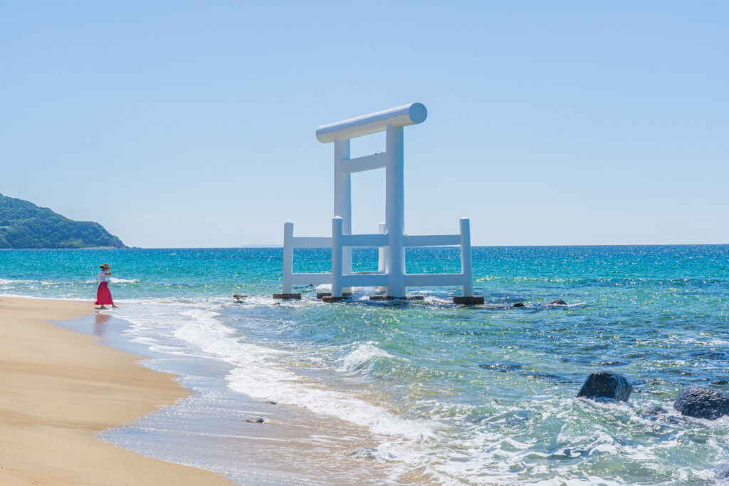
16:50
If you still have time, stop by the “Sakurai Futamigaura Couple Rock” in Itoshima before returning to Fukuoka.
The sight of a pure white torii gate facing the husband and wife rocks offshore is very popular as a great photo spot. There are also stylish cafes and Instagram spots scattered around the area.
50min
7
Rental car branch at Fukuoka airport or Hakata Station
Parking MAPCODE:
Please head to the rental car branchWhat is MAPCODE?
18:10
This concludes your Kyushu road trip.
When you return to Fukuoka, refuel and then return the car to the car rental branch. Use the MAPCODE on the driving map for the nearest gas stations at Hakata Station and Fukuoka Airport.
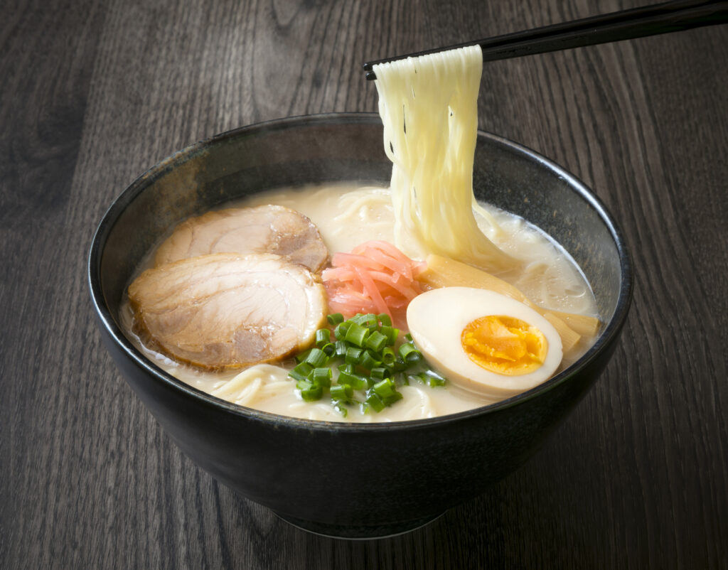
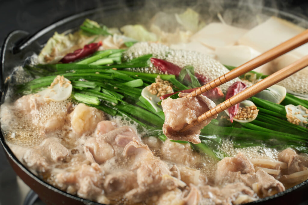
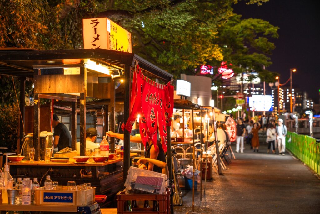
Fukuoka offers a wide variety of culinary delights. For dinner, try Hakata ramen, Motsu nabe (Motsu hot pot), and other local Fukuoka foods, or even try one of the famous Yatai stalls.
The driving map will show additional 10-20 sightseeing spots and local restaurants for the day!
You can travel freely, choosing only the spots you like!
Check pin color and MAPCODE usage.
Fukuoka is the biggest city in Kyushu and the gateway of Kyushu Travel. It takes 15min to Fukuoka Airport by subway. There are hundreds of accommodations around “Hakata Station”, Nakasu downtown area, and Tenjin Station.
- Inn Type
Most of these inns are 2 to 5-star western-style hotels. - Parking
Some inns have official parking but in addition to the accommodation fee, the parking lot fee will be charged separately. - Onsen
There is no Onsen in this town and no inns have Onsens. - Meal Plan Reservations
As many restaurants are open till midnight, it is recommended to book your inns with breakfast only or without meals.
Process
- Highly recommended to book a rental car first to book hotels with special discounts.
- Book hotels. Recommend hotels have parking and convenient locations for dining and strolling. Selected hotels can be booked with a single payment.
With rental car booking number, you can book hotels with exclusive discounts(Avg.18%, Max45% OFF)! - You will receive day-by-day Driving Maps with parking MAPCODE of the itinerary you choose! Enjoy your trip without the hassle of finding parking!
Rental Car Booking
Please rent a car with below “Rentalcars.com” link.
- The abundant number of rental cars
- Price comparisons with several major car rental companies
- Free cancellation

Pick-up & Drop-off Location Guide
-
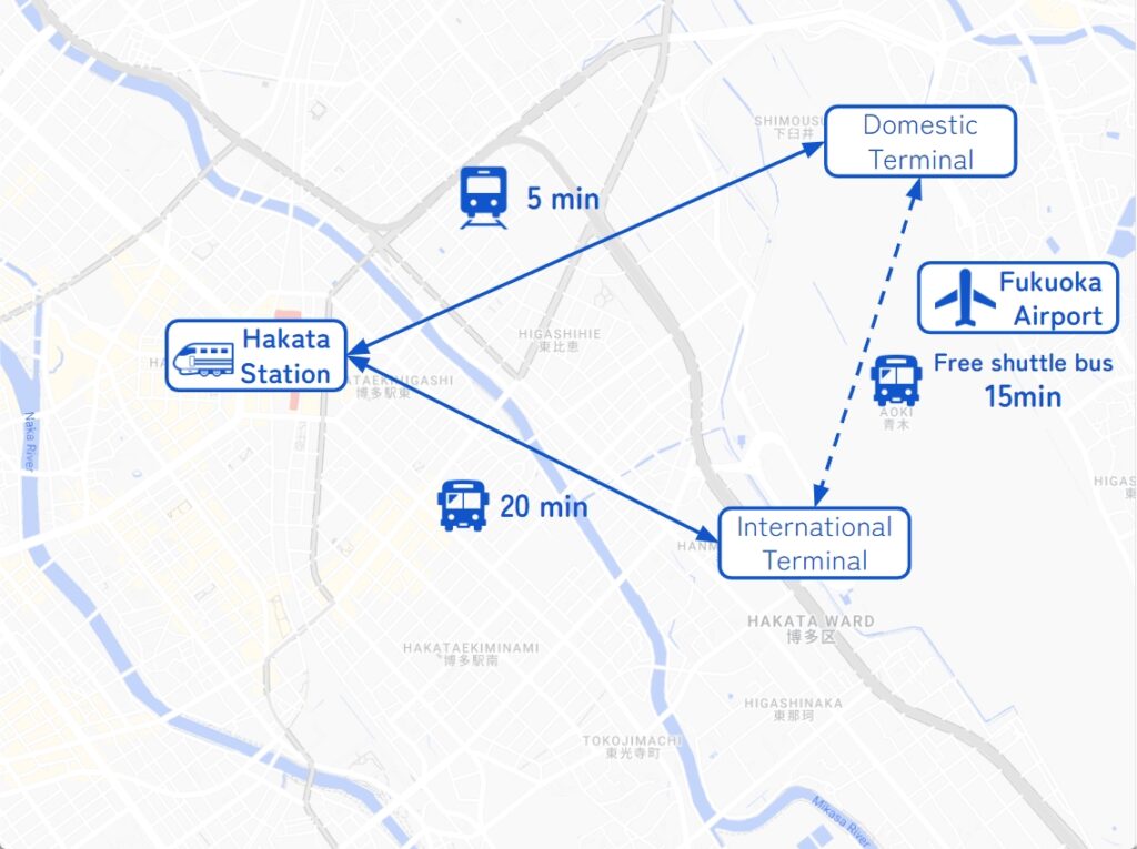
Fukuoka Airport
The main international airport in Kyushu. Recommended for Pick-up.
If you arrive after 14:00, consider staying overnight in Fukuoka City and departing the next morning.
It takes 5-20min to Hakata station by metro or bus. -
Fukuoka City
The biggest and gateway city in Kyushu. Most car rental shops are located around Hakata Station.
Important reminder for renting a car
-
GPS(Car Navigation System)
MAPCODE from Drive Japan navigates you precisely to the parking lot. GPS from major car rental companies(Nippon, ORIX, Nissan, Times) are always MAPCODE compatible. However, if you are renting a car from another company, we recommend that you check with the rental company after making a reservation, just to be sure. -
One-way Rental
You can rent at Fukuoka Airport and return to Fukuoka city, and vice versa. Normally, the one-way charge is free of charge. -
Child Seat
In Japan, the use of a child safety seat or baby seat is mandatory for children under 5 years old.
Be sure to request one from “Extras”. -
Snow Tire
Kyushu rarely gets much snow, even in winter. However, if you drive around Aso from December to February, recommend requesting it.